|
Date: Sunday, October 19, 2014
Time: Meet at 9:30 am. Ride starts at 10:00 am
Direction: From Bay Area to Fort Ord Dunes State Park, going south on Hwy #1
1. From Hwy #1, exit Lightfighter Drive (Bear Right)
2. Turn left onto 2nd Avenue.
3. Turn left onto Divarty Street.
4. Turn right onto 1st Avenue.
5. Signs posted will direct you to the park entrance at the 8th street overcrossing of Hwy #1.
Start Location: Fort Ord Dune State Park parking lot. Look for CDW banner!
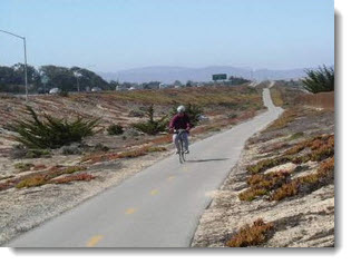
Distance: The out and back route is 23 miles long with a few gentle rolling hills that centenarians should have no trouble conquering.
Type of Bike: Any
Ride Classification: Leisurely (up to 10 mph) to touring (10-13 mph). G5 Rated (easiest ride) means that there is a section with at least a length of 300 meters and a grade of 3%, which means 1/3 of mile may be a little difficult for some of us.
Climb Rate:
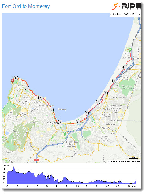
Distance: 11.5 mi (one way)
Elevation: + 397 / - 472 ft
Max Grade 5.7 %
Avg. Grade -0.1 %
Ride Leaders: Bob Morrison, bobcdw@gmail.com, VP: 510-585-9527 or text 650-219-7958. Please confirm by Saturday, October 18 with your name. Extreme temperatures or bad weather conditions may modify the route at the leader's discretion. Rain cancels. Backup ride leaders are Ethan Bernstein and David Peterson.
Lunch: TBD by ride leader. There are several excellent restaurants in Monterey.
Safety: Wearing a helmet is mandatory in all CDW rides.
What to Bring: Locks, spare tube, patch kit, tire irons, pump/CO2 inflator, multi-tool, water bottle, identification card, medical card, cellular phone, and money for the lunch.
Before the Ride: Check the wheels) quick-release skewers are tightened correctly), inspect the tires for air pressure (with a floor pump's meter, not your thumb), test the brakes, lube the chain, and check the shifting.
Weather: Weather may be unpredictable. Layered clothing is advised.
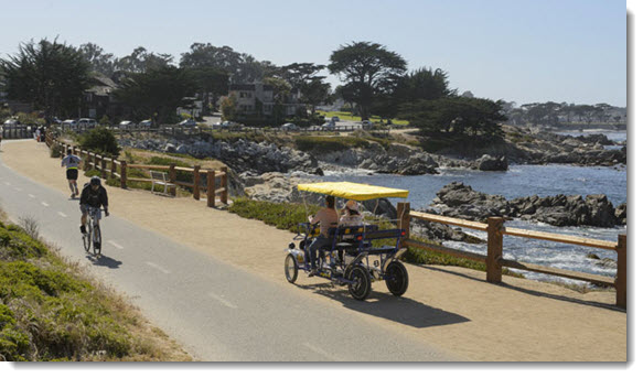
About the Trails: (The original trail is actually 29 miles in length but we will do our shorter version). The waterfront Monterey Bay Coastal Recreation Trail stretches 11.5 miles, from Fort Ord Dune State Park in the north to Pacific Grove in the south. This popular paved path hugs the coast, following the same route as the old Southern Pacific Railway. The recreational trail is a great way for families to reach the Monterey Bay Aquarium and Cannery Row, the American Tin Cannery shopping and outlet mall, the Museum of Monterey, Fisherman's Wharf, and much more - avoiding busy roads all the way.
Websites:
Route Planner: Ethan Bernstein
Announcement Written by: Ethan Bernstein
|