|
Date: Saturday, August 8, 2015. Meet at 9:30 am. Ride starts at 10:00 am
Location: 880 Tully Rd, San Jose
Directions: From north, take 101 South and get off at Tully Road. (Exit #383) Turn right onto Tully Road, go about 2.5 blocks, then turn left at Galveston Ave, and then make a sudden right turn into the parking lot, which will be our staging area.
From the south, take 101 North and get off at Tully Road, and turn left onto Tully Road. Go about 2.5 blocks and turn left at Galveston Ave. then make a sudden right turn into the parking lot, which will be our staging area.
There is a library on the left side and four baseball fields in the middle and right side. Take the right side parking lot.
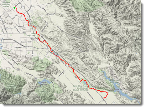
Miles: We have two routes. Route A is for pure recreation which is 18 miles round trip and Route B is for more serious bikers which is 44 miles round trip.
Type of bike: Any type
Ride Classification: Leisurely (Route A) to Touring (Route B)
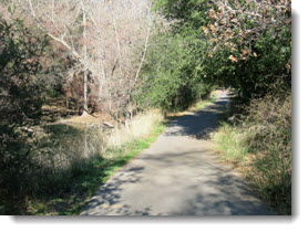
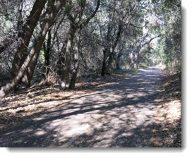
Climb Rate: For Route A, 403 feet. For most of the way, the trail meanders along the Coyote Creek south of the city of San Jose. The first 3 miles contains several slopes , one of which is 5% gradation with a hairpin turn. It also includes a velodrome, which is in use every Saturday morning, and you might want to stop and check out this activity. There is also a rest room here. The next 6 miles are very flat but contain fibrous root bumps. For Route B, everything is the same but you can continue on the same trail for 11 more miles.
Meal: There are no eateries along the way, so bring a brown bag lunch and we will stop at Metcalf Park, which is 9 miles from our staging point. There are picnic tables, rest rooms, playground. After lunch, you can start back to the parking lot or continue to the end of the trail then turn back.
Ride Leaders: Bob Morrison; bobcdw@gmail.com. Please confirm by email by March 7. No one left behind. Extreme temperatures or fog conditions may modify the route at the leader's discretion. Rain cancels.
Safety: Wearing helmet is mandatory.
What to bring: Spare tubes, patch kit, tire irons, pump/CO2 inflators, multi-tool, water bottle, identification/money/medical card and phone.
Route Planner: Ethan Bernstein
|
