|
Time: Meet at 8:00 am
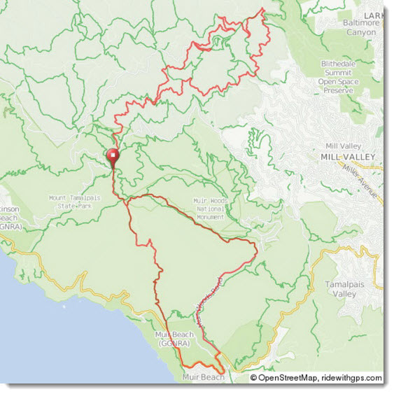
Start Location: Pantoll Ranger Station, Mt. Tamalpais State Park, 3801 Panoramic Hwy, Mill Valley, CA 94941
Directions: Head south on US-101 S; Take the exit toward Stinson Beach; Merge onto CA-1 S; Turn left onto CA-1 N; Turn left to stay on CA-1 N; Keep right to continue on Panoramic Hwy; Pantoll Ranger Station parking lot is on the left.
Fee: Parking fee
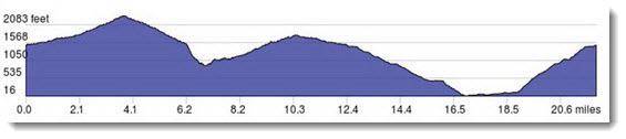
Distance: 12 mile loop ride (everyone) or 22 mile loop ride (intermediate and up)
Type of bike: Mountain bike
Ride Classification: Beginner and up (fire roads, gravel trails, some single track, steep hills).
Total Climb: 3340 feet for 22 mile loop
Description: Single track, fire roads and paved roads
Meal: Bring your own lunch (meal stop between loops)
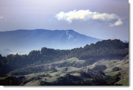
About the Park: Mount Tamalpais, considered by many to be the birthplace of mountain biking, boasts a long and colorful fat-tire history. In the mid-70s such now venerable names as Joe Breeze and Gary Fisher were pushing the limits of their specially rigged bikes down trails such as the infamous Repack (technically a bit north of Mount Tam). - See more information at Mount Tam Mountain Bike Trail Map.
Ride Leader: Ethan Bernstein, ethanab@comcast.net or text 510-673-3386 with your name. Please confirm by email by the day before the date of ride. No one left behind. Extreme temperatures or poor weather conditions may modify the route at the leader's discretion. Rain cancels.
Safety: Wearing helmet is mandatory for all club group rides.
What to bring: Spare tubes, patch kit, tire irons, pump/CO2 inflators, multi-tool, water hydration system/water bottles, identification/money/medical card and phone.
Before the Ride Maintenance: Check the wheels (quick-release skewers are tightened correctly), inspect the tires for air pressure (with a floor pump's meter, not your thumb), test the brakes, lube the chain, and check the shifting.
Website: See more information at the state park's brochure and map.
Route Planner: Ethan Bernstein
|